Showing posts with label National Park. Show all posts

Thursday, 10 March 2016

A walk on the wild side? The Pembrokeshire section of the Wales Coast Path

For 186 breathtakingly rugged miles, the Pembrokeshire section of the Wales Coast Path promises days full of seabirds, seals, puffins and even the occasional dolphin. Tony Bowerman says it’s unmissable.


Green Bridge

It’s official: Pembrokeshire offers world-class walking. Recently voted the “world’s second-best coastal destination” by National Geographic magazine and, in 2011, named the second in a list of the “world’s top ten long distance paths”, the Pembrokeshire coast path is definitely a dream destination for walkers.  The lovely Pembrokeshire section of the Wales Coast Path undulates along the top of rugged cliffs, in and out of secluded coves and tiny harbours, and along numerous sandy beaches.
Strumble Head

From the remotest reaches of the north coast near Strumble Head on day one to the popular beaches around Tenby on the final day, it provides a wonderfully varied experience. Whether you come for the scenery or the solitude, the wildlife, Welsh history, language and culture, or simply to immerse yourself in an exceptional corner of Britain, Pembrokeshire certainly won’t disappoint.


Pembrokeshire’s unique qualities were recognised as far back as 1952 when it became one of Britain’s first National Parks. The path traverses several National Nature Reserves, lots of Sites of Special Scientific Interest and one of the UK’s four Marine Nature Reserves, all helping protect the area’s geology, habitats and wildlife.  Along the way, you’ll encounter countless seabirds — including puffins, peregrines, choughs, gannets and fulmars.  You’re also likely to see plenty of inquisitive seals, and if you’re lucky, porpoises and dolphins.  But most memorable, perhaps, are the spectacular carpets of maritime wildflowers that colour the cliffs and offshore islands in spring and early summer.

Pembroke Castle
As well as ever-changing scenery, the coast path is a walk through history too.  Cover the whole route over fourteen or so days and you’ll discover prehistoric burial chambers near Fishguard, Aberdraw and Manorbier, standing stones and hillforts, dramatic medieval castles at Pembroke and Manorbier again, tiny Celtic chapels and atmospheric St David’s Cathedral.  Several sections of the coast are also managed and protected by the National Trust.


Wonderful walks 

For the first few days, the Pembrokeshire section of the Wales Coast Path runs along the rugged north coast with its high, often remote and windswept cliffs. Along the way, it drops in to Newport, Fishguard and the tiny cathedral city of St David’s.

Once round the St David’s peninsula, the path enters St Bride’s Bay, with its hidden coves and historic headlands. Beyond the Marloes peninsula and St Ann’s Head, the coast becomes more developed around the Milford Haven, before rounding the Angle peninsula, and passing through spectacular limestone and sandstone scenery on its way to lovely Tenby and its end at Amroth, on the Pembrokeshire/Carmarthenshire border.

Carreg Samson cromlech
Favourite day walks include the section between Stack Rocks and Bosherton Lily Ponds, passing the amazing sea arch at the ‘Green Bridge of Wales’ and tiny St Govan’s Chapel hidden in a cleft in the cliffs. For a longer, two day walk,  I recommend the stretch from Strumble Head to Whitesands Bay. It’s got some of the best dramatic scenery on the whole Pembrokeshire coast and a host of prehistoric remains including the fascinating Carreg Samson cromlech.


More information:


For a detailed guide to the 186-mile linear route, get hold of a copy of the Official Guide: Wales Coast Path: Pembrokeshire by Vivienne Crow.

(ISBN  978-1-908632-23-4 | £13.99).

For details, see: Official Guide: Wales Coast Path: Pembrokeshire


Or if you prefer short, circular walks along the coast, try the two attractive pocket-size ‘Top 10 Walks’ books for the Wales Coast Path: Pembrokeshire — North and South, both by Dennis Kelsall.

(ISBNs  978-1-908632-29-6 and 978-1-908632-30-2 | £5.99 each).

For details, see: Pocket-size ‘Top 10 Walks’: Pembrokeshire


Wednesday, 13 March 2013

Walking and Outdoors books on the Kindle


The times are a-changing and the rise of e-readers - and in particular the Amazon Kindle - has brought a new way of reading books.

In contrast to some other genres, the walking and outdoor publishing community has been a bit slow on taking up making books available on the Kindle - or across devices like the iPad and Android tablets - but that is changing, and I've got a few of the best ones I've found here on our blog.


An area of England with an amazing amount of walks - and sadly very much overlooked is Warwickshire & West Midlands - was is why Richard Sale's book 100 Walks in Warwickshire & West Midlands is included here.  The walking territory in these two central counties remains largely undiscovered, better known, as they are for their towns and cities such as Stratford and Leamington.  Those willing to find out, however, will discover some wonderful countryside, and some surprisingly varied routes.

It's quite an old book - originally printed in 1996 - but the walks contained within are among the best in the area.  The maps are line drawings, not OS ones - but they are very clear and easy to read, with plenty of places of interest noted on each walk.


As our good friend Tanya Oliver pointed out in the sixth edition of the Walks Around Britain podcast, Sussex is a great country to walk around - and Richard Williamson's book 52 Favourite West Sussex Walks has a great selection in it.  Richard Williamson’s weekly walking column has long been one of the most popular features in the Chichester Observer, Worthing Observer and West Sussex Gazette, and for the first time he has compiled his favourite walks – one for every week of the year – with hand-drawn route maps.

Many here to to tempt you out onto the unspoiled nature of the timeless South Downs landscape and its varied flora, fauna and stories – from bat-birds and the Devil’s Jumps to beloved pubs and famous poets – combine with practical notes on routes that can be covered easily in an afternoon.


Although it's not a walking route book, but Tristan Gooley's latest book The Natural Explorer: Understanding Your Landscape: In Search of the Extraordinary Journey is certainly worth a mention here.  You wont find a map in this book, but you will learn how to read, understand and connect with the landscape.  I've got a review on this book on this blog soon, so I'm not revealing too much here, but I can tell you it's a cracking read.  And the best bit is that the Kindle edition is onnly £4.99 - saving nearly a massive £6 of the hardback price!

Tristan was on the Walks Around Britain podcast in May - here's the podcast along with the Show Notes on this blog.


Tripping North of the Border to the fabulous Isle of Skye, and the famous outdoor author Terry Marsh has written possibly the definitive book on walking and hiking on the island - The Isle of Skye: A Walker's Guide.

Most people are drawn to the island for the Cuillin, but there is more to Skye - and this book has 87 walks and scrambles.  The Isle of Skye has some of the most awe-inspiring scenery of Scotland's many islands. The walks are widely varied, and provide something for all abilities to enjoy.

The guide is one of the famous Cicerone walking books, who are more than half way through converting their epic collection of titles to electronic formats - and this is an e-book which benefits from using a Kindle app on a smartphone or on a computer, as it is in full colour.


And lastly, this very blog is available on the Kindle as well on a monthly subscription.

Thursday, 25 October 2012

An exciting future for the Lake District's Visitors Centre


In the atmosphere of cut-backs we find ourselves in, it is indeed refreshing to hear about the success of the Lake District Visitor Centre at Windermere - Brockhole.


The next monthly meeting of the Lake District National Park Authority (LDNPA) members will be told the strategic masterplan redevelopment programme for Brockhole is well on the way to turning around the fortunes and future of the centre.

The man in charge, Programme Director Adam Thomas (right), will explain how the number of people visiting the popular lakeside attraction is increasing and at the same time the centre is dramatically reducing the financial  impacts it has on the LDNPA’s overall budget.

His interim report detailed how, in July 2007, the authority set out its intention to turn Brockhole into “a world class visitor attraction”. Already the centre has been transformed by:

The new jetty at Brockhole - photo courtesy of LDNPA

  • building a new jetty to accommodate all Windermere Lake Cruises’ ships;
  • creating a Tree TopTrek woodland adventure course;
  • increasing watersports availability;
  • improving catering facilities; and
  • developing greater retail opportunities.


Visitor numbers to the centre have increased from under 100,000 to 230,000 and the amount of subsidy required has fallen from  £315,000 to £187,000 in the current financial year.

In November, members will receive an updated report detailing in full future plans for areas such as: building a new visitor centre; garden restoration; improving viewing areas; staging large-scale events; car parking; and access changes to the main entrance.

With the news of so many visitor facilities facing reduced opening hours or indeed closure, it is fantastic news to hear about the success of Brockhole.


Please let us know what you think about this news by leaving comments below.


Sunday, 21 October 2012

Hungry pub goers and walkers help the Yorkshire Three Peaks

Special pub meals and a book of walks have been raising much-needed cash to help maintain footpaths around the Three Peaks of the Yorkshire Dales National Park.


The Lion in Settle decided to help by donating 15p every time a hungry visitor to the pub ordered a main course dish called ‘Butchers Board’.

And manager Ian Pilcher has handed over a cheque for £250 – raised from more than 1,600 meals – to the Yorkshire Dales National Park Authority (YDNPA) for its Three Peaks Project, which was launched in 2009 to maintain the heavily-used network of paths connecting the famous hills.

“I think it’s really good to support a local organisation that conserves the area,” Ian said.
“Most of our customers come to walk in the Three Peaks, and the menu choice proved very popular. We’ll do the same again over the coming winter.”
From left to right: Ian Pilcher, Chris Grogan and Steve Hastie in the restaurant at the Lion in Settle.

The first Three Peaks Project was established by the YDNPA in 1987, after a study by the Institute for Terrestrial Ecology carried out a study of the condition of the path network in the Three Peaks area.  It  concluded that the region had the sad distinction of possessing the most severely eroded network in the UK.

Originally started with a staff of 13, its remit included trialling new path-engineering and re-vegetating techniques to provide sustainable routes and to allow damaged surrounding land to recover.  The mid-90s and early 2000s saw a number of externally-funded projects completed, each with one or two extra staff appointed.


However, since 2004, the management and maintenance of the Three Peaks network has reverted back to the YDNPA’s Rangers – a team of just two officers covering the whole of the wider Ribblesdale area.

The latest project aims to create a sustainable source of both practical and financial support that will help protect and enhance the area and the rights of way network into the future.  Since its launch, many of the charities that regularly use the Three Peaks for sponsored events have volunteered to donate money towards the upkeep of the area.


At the same time, the authors of a book of walks from stations along the world-famous Settle Carlisle railway line have been doing their bit to help the project.

Tony and Chris Grogan from Saltaire-based publishers Skyware Ltd decided that a proportion of the proceeds from the sale of each copy of ‘Dales Rail Trails’ would be donated to the Friends of the Three Peaks, a group run by the National Park Authority.

Chris has passed on a cheque for £200 generated from sales of the book over the spring and summer.

“I’m very happy that we are able to donate to the Friends of the Three Peaks, and that sales of the book have gone so well,” she said.

“It has only been on sale since the spring so we’re hopeful that we can make further contributions.”

The book was funded by the YDNPA’s Sustainable Development Fund – which is managed by the Yorkshire Dales Millennium Trust – and has sold more than 650 copies since going on sale at the beginning of the year priced £8 99.

It contains 32 walks from stations along the railway line as well as a guide to the popular, 24-mile Three Peaks Challenge route and details of the 48-mile Six Peaks Trail, which links stations from Settle to Kirkby Stephen.

Steve Hastie, the YDNPA’s Three Peaks Project Manager, said: “The great thing for me is that these fundraising ideas came from Ian, Chris and Tony.

“Our Corporate Friends have really started to get to grips with the challenges facing the wonderful Three Peaks and they are making very useful, positive contributions.”

If you'd like to become a Friend can log on to the YDNPA website at www.yorkshiredales.org.uk/threepeaks and follow the pages to join online.

And you can watch our walking video around the Ribblehead Viaduct, which takes in part of Whernside below.


Tuesday, 16 October 2012

Making improvements in the Ogwen Valley


With around 250,000 visitors every year, the Ogwen Valley is an extremely popular location - it's just a shame the current Warden's building does not do justice to its setting.


The building was originally designed as a garage, snack kiosk and toilets at the end of 1970 and, over the years, it was converted to provide office, storage and interpretation areas.

But, in early November, construction will start on providing a brand new building.  The proposed new facilities at the Centre will include an office for 3 people, toilets, changing areas, food kiosk, and a sheltered area for interpretation which will be suitable for groups, monitors providing 24 hour weather information and visible from the outside, interpretation panels, assembly points for groups, and curtilage area which will separate cars, people and parking facilities for bicycles.


These much needed improvements in the Ogwen Valley - which is to the North East of the peak of Snowdon - has come through the Cwm Idwal Partnership, a combination of the Snowdonia National Park Authority, the Countryside Council for Wales and the National Trust.  Funding is from the CAN strategic project (Communities and Nature) through the European Development Fund and the Countryside Council for Wales through the Welsh Government.

Emyr Williams from the Partnership, said,
"The facilities at the Warden’s base in Ogwen were limited and basic, and did not offer the best service or provision for the 250,000 visitors who visit Ogwen each year. The new Cwm Idwal Centre will be a gateway to Snowdonia, and one which will improve people’s understanding and enjoyment of Cwm Idwal, Ogwen Valley and the surrounding area. It will also attract a wider audience to take advantage of the various recreational and educational opportunities available here. "

Construction work should be finished early in 2013 ready for opening in the summer.  In the meantime, snacks and drinks facilities will not be available at the site - but there will be temporary toilets and parking spaces will be limited during the construction period.


Saturday, 13 October 2012

Five of the top British Isles walking destinations


Taking a walk with the family is a great way to spend some time together and to get healthy exercise, but how many times can a family walk around their own neighbourhood.  After a while, the same old route may get a little boring.  That’s why planning a walking holiday for the next family trip may be just what the doctor ordered.


A walking holiday is perfect for people of any age that want to get away, see some spectacular sights, and not gain weight while traveling!  That’s why walking holidays are great for the whole family – it keeps mum and dad active and allows the kids plenty of things to see and do.  A walking holiday can include everything from a long-distance hike to relaxed strolls along a coastal path; it just really depends on the destination.  So here are five of the top walking destinations in the British Isles to consider for the next family holiday.


Lake District

The Lake District is one of the most beautiful and serene destinations in the United Kingdom.  The scenic beauty of the lakes and mountains has attracted millions of visitors over the years and is the ideal backdrop for a walking holiday.  Be sure not to miss the Southern Fells, home to Scafell Pike, the highest mountain in England - though every area within the district is ideal for an extended trip or a quick weekend getaway.  Families may rent a cabin or choose to camp in the Lake District National Park.  Camping allows families to bring their own village garden furniture for comfortable al fresco dining.  Using a campsite as a base the family can enjoy the easy, moderate, and difficult walking trails, which vary in length, at their own pace.


Isle of Man

The Isle of Man is one of the best locations for a walking holiday simply because there is so much space.  Measuring 33 miles in length and being 13 miles wide, this destination offers some of the most breathtaking countryside views in the British Isles.  For families that want to get a taste of every type of scenery the British Isles has to offer, the Isle of Man has it all – majestic highlands, layered cliffs, valley slopes, woodland glens, and of course sandy beaches.  With miles of footpaths, the Isle of Man is ideal for hiking beginners, leisure walkers, and families with young children as well as the most experienced walker.  Remember though, the Isle of Man isn't part of the UK, so you'll need some form of photo ID to travel to and from.


Norfolk Coast Path

Between Cromer and Hunstanton, the Norfolk Coast Path offers an enjoyable route for any enthusiastic walker on holiday.  Following along the coastline, this national trail has an abundance of wildlife that can only be seen in the UK. There is birdlife in abundance and the walk passes through some nature reserves.  Salt marshes, sandy cliffs, and crashing waves are features of the Norfolk Coast Path.  Because the path remains at sea level, there is some walking on the shingle shoreline and the beach itself; these sections can be quite tiring.  Do not be put off by this, as this is a wonderful coastal path that rewards its users with some wonderful scenery.


North York Moors

For a dramatic coastal walking holiday and a taste of the wild upland moorlands, the North York Moors are the perfect destination.  The interesting ancient villages with ruined abbeys and a restored steam railway complement the beautiful rural scenery.  Walking enthusiasts will enjoy the well-developed footpaths offering a wide range of walks.  Covering almost 600 square miles, the North York Moors is home to one of the most picturesque national parks in the United Kingdom.


South West Coast Path

For those hoping to experience a walk to remember, the South West Coast Path is one of the longest national walking trails in the UK.  With a variety of landscapes and seascapes, it is also one of the most challenging.  Don’t forget the camera and good walking shoes on this trail, as the high cliffs and rich wilderness are a sight to behold while proving to be a great challenge every step of the way.


You can find walks in the Lake District, the North Yorks Moors, the Isle of Man and the South West Coast Path on our website - Walks Around Britain.  We're adding some along the Norfolk Coast Path very soon.

Have we missed out you're favourite destination?  Please let us know what it is and why.

Monday, 8 October 2012

Details for the Snowdonia Walking Festival finalised.


In October, the Snowdonia National Park Authority and the Wales Air Ambulance are again joining forces to organise the Snowdonia Walking Festival.

Every day, at 10.00am, on October 12th, 13th and 14th, twelve interesting and educational guided walks will start off at different locations in Snowdonia.  Each one is led by a local, knowledgeable and experienced leader and will vary in distance, grade and time.

During the festival, six guided walks will be held in the northern area of the Park and will include walks along the foothills of the Carneddau from Llanfairfechan, Abergwyngregyn Falls, the Bridges Walks from Betws y Coed, Cwm Idwal, and along the Pyg Track.  In central Snowdonia, walks have been organised from Croesor, Cwm Bychan and an archaeological themed walk to Tomen y Mur near Trawsfynydd.  In southern Snowdonia, the guided walks include the Panoroama Circular Walk from Barmouth, Foel Caerynwch from Brithdir and the Precipice Walk from Llanfachreth.

Booking is essential for each walk and a fee of £15 or £20 will be charged per adult but with all proceeds going towards Air Ambulance Cymru.  Participants will also receive a sponsorship pack which includes a sponsor form, Wales Air Ambulance goodie bag and an exclusive discount voucher at Cotswold Outdoor Clothing.

Valmai Mattula, from Air Ambulance Cymru, said,
“Snowdonia is famous the world over for its majestic, rugged beauty and the Snowdonia Walking Festival not only gives you a chance to explore this stunning National Park, but it also provides an opportunity to raise vital funds at the same time. Individuals and families can come along and we can also offer corporate packages for businesses looking for ways of fundraising with colleagues, or who would like to work on team-building skills and fulfil social responsibility schemes.” 

Snowdonia National Park Warden Dewi Davies is one of the Guides during the festival.  He added,
“Going on a guided walk is one of the best ways to learn about the history, geology, culture and biodiversity of the area whilst appreciating the beauty and special qualities of Snowdonia at the same time. What we cannot guarantee however is the weather! Walkers should wear comfortable walking boots, a warm waterproof and windproof coat or jacket, and gloves and a hat. A rucksack with plenty of food and drink, extra water and sunscreen can also be handy.”

Further details on the festival and booking arrangements can be viewed at www.walesairambulance.com.

Thursday, 2 August 2012

Podcast Edition 007 - Show Notes


Edition 7 of the Walks Around Britain podcast features a walk around Ashdown Forest in Sussex with Tanya Oliver and a look at National Parks Week. Andrew takes a flight over the Dark Peak reservoirs with Central Helicopters and walking writer Christopher Somerville tell us about his latest walks and his new book.

Ashdown Forest

Ashdown Forest - photo (c) Ashdown Forest
The walk through Ashdown Forest gives us a great taste of the rich walking available in the county of Sussex.

The Forest was originally a deer hunting forest in Norman times, Ashdown Forest is now the largest free public access space in the South East. It is a great place for walking and enjoying spectacular views over the Sussex countryside and is known the world over as the 'home' of Winnie-the-Pooh.

To find out more, visit the Ashdown Forest website here, and Visit Sussex has more information about walking in the county.  You can find Tanya Oliver's blog here and also follow her on Twitter.


National Park Week

This year's National Parks Week is a celebration of our beautiful winning landscapes which have inspired mountaineers, sailors, cyclists, runners and Olympic athletes to aim higher and train harder - sometimes to record-breaking effect.  And there's many events to interest both children and adults across the 15 National Parks in Britain.

To find out more information, visit the National Parks portal here.


Central Helicopters

Andrew took a flight with the team from Central Helicopters from Owler Bar just outside Sheffield, over the moors of the Dark Peaks to the 3 reservoirs of Ladybower, Derwent and Howden.


The footage Andrew shot will be including in several walking videos we're making about walks around the Dark Peak area of the Peak District.

The shot on the left is from our forthcoming walking video around part of the Ladybower Reservoir with Andrew's dog Merlin - which will be exclusively available on the Bob Martin website and Facebook page.

To find out more about Central Helicopters' range of pleasure flights, visit their website.


Christopher Somerville

Christopher is one of Britain's most prolific walking writers, with a weekly column in The Times newspaper and a collection of over 40 walking and travel books to his name.

August sees another book added to that tally - "Walks in the Country Near London" features 25 walks within 1 hours train ride from the centre of London.

It is available from Amazon here.

Thursday, 14 June 2012

New Forest's smallest visitor information centre celebrates its first birthday

It's the New Forest's most unusual visitor information centre - and it recently celebrated its first birthday.


The iconic BT telephone box was last year transformed by the local community after Lyndhurst Parish Council adopted it as part of the UK-wide ‘adopt a kiosk’ scheme for £1.

With help from the New Forest National Park Authority they installed information and local history panels, a map for walkers and swap shop for books, DVDs and local produce. The village pub (New Forest Inn) even donated a dog bowl. It also has a notice board advertising everything from film nights to church services and a donations box.

Jim Mitchell, Interpretation Officer at the New Forest National Park Authority, said: ‘The community has worked really hard and it’s good to see it paying off. They continue to dedicate their own time towards this project that not only helps the whole community but also passers-by and walkers.

‘It was great to be part of this and it’s good to hear about people using the kiosk and learning about this special area of the National Park. The kiosk is in the street that was almost certainly the birthplace of ‘Brusher’ Mills, the New Forest’s famous snake catcher.’

Emery Down resident Peter Power was one of the driving forces behind the project. He said: ‘It has been a great first year - the kiosk and a large display of local history have proved to be very popular.

‘We have also been overwhelmed by people’s generosity making donations. In the first 12 months we have received over £350 which has helped purchase banners, light bulbs and much more for the nearby village church.

‘We have received so much positive feedback in our visitor’s book from people travelling from as far away as Australia.’

The telephone box is on the Lyndhurst Parish walk, a 13.5km trail that takes in Lyndhurst village centre, Bolton’s Bench and the Forest.

Part of this track from Silver Street to Blackwater has recently been upgraded thanks to grants from the New Forest National Park Authority’s Access Forum and Hampshire County Council’s Access Forum with help from the Forestry Commission. This will now provide an alternative route for walkers to Mill Lane away from the busy road.

Tuesday, 12 June 2012

Actor Hugh Dennis opens a new attraction at Sutton Bank


Hugh Dennis - photo copyright Gazette Herald

Writer and comedy performer Hugh Dennis recently officially opened the new visitor attraction at Sutton Bank National Park Centre in the North Yorks National Park.

Using a combination of innovative computer graphics, touchscreen technology and children’s interactives, the new attraction reveals the story behind the creation of the dramatic landscape at Sutton Bank and how it has shaped people’s lives through the ages. Entry to the new attraction and the centre is free.

Although the high inland cliff of Sutton Bank was created during the last ice age some 20,000 years ago, its layers of rock tell the story of more than 60 million years of the earth’s history. Part of the new attraction is a computer generated film, narrated by earth historian Professor Aubrey Manning, which in five minutes takes people through this amazing geology story from its beginnings under tropical oceans through to the present day.

Using touchscreens people can access more information about the area’s geology but also watch short films and read tales of those who’ve lived, worked and been inspired by the area. These range from Bronze Age settlers who used the hillforts of Boltby and Roulston Scar to rest and trade their animals to more modern day tales of gliders and the Sutton Bank ‘road man’ who helped motorists get up the steep hill. Through various interactive play facilities, the new attraction also aims to give children a greater understanding of why the area is such an important and special place.


To help people get out and explore the Sutton Bank area, an iPhone app with four walking routes has been developed and the National Park Authority has created an easy access trail that wends its way from the National Park Centre to a new viewing platform on the escarpment edge.

Hugh Dennis recently visited Sutton Bank while filming the BBC’s ‘Great British Countryside’ series in which he went up in a glider to explain how the iconic landscape was created. He said:
“The fact that our lives are still affected by events that happened millions of years ago continues to interest and intrigue me. Sutton Bank is one of the most impressive features of Yorkshire’s landscape and has a fascinating tale to tell. This new attraction will I’m sure provide a whole new level of enjoyment and understanding for people who visit.”

More than 10,000 people visit Sutton Bank National Park Centre to go for a walk or bike ride, find out about the wider area or simply to admire the beautiful panoramic views - and the new visitor attraction shows there's much more to the area than stunning scenery.

The new attraction at Sutton Bank National Park Centre has been developed as part of the five year Lime & Ice Project which is providing new opportunities for people to explore, enjoy and learn about the south-west corner of the North York Moors National Park and the northern half of the adjoining Howardian Hills Area of Outstanding Natural Beauty. The project is funded by a grant of just under £500,000 from the Heritage Lottery Fund.

Sutton Bank National Park Centre is on the A170 between Thirsk and Helmsley. It is open daily in spring and summer with reduced opening during the winter. More information on facilities at the centre, opening times and contact details can be found at www.northyorkmoors.org.uk/suttonbank

Sunday, 10 June 2012

Some of our old "mini-Podcasts"

Way back in the mists of time - well, before March 2012 - we made a few mini Podcasts lasting around 5 minutes.  Now, these have largely been forgotten with launch of our bigger and better monthly walking and outdoor podcast - but we though some of our newer followers might not have heard them.

So here's a few of them for you to peruse...


Friday, 1 June 2012

Podcast Edition 005 - Show Notes


Edition 5 of the Walks Around Britain podcast features the team of Sixth Formers attempt to bag some Munros and we find out about a new map about the Munros - and it's older Lake District cousin.  Richard Vobes - the Bald Explorer - takes us along the Dorset Coastal Path and weatherman Fred Talbot tells us about his walking treks and lyrca.


LVS Ascot Great Wilderness Munro Challenge

Six intrepid Sixth Formers from the LVS Ascot School in Berkshire - Kieren Exley, Jamie Goldsmith, Idris Adedeji, Charlie Morgan, Jack Bingham and Ben Pearson - should be very proud of their recent adventure, as they along with three mad teachers returned safely after taking on the several Munros in North West Scotland.

Teacher Nick Funnell tells us about the challenge on the podcast.

If you'd like to donate to the challenge, visit the Just Giving website here.  At present, 31st May 2012, the total raised was a massive £2,722.50.


Tubular Fells and MunrOverground

Tubular Fells was the first map of its kind, blending the iconic work of Alfred Wainwright and Harry Beck - the designer of the London Tube map.  Using the same formula, the second map MunrOverground has been created to map the Scottish Munros in the same topological way, but this time looking more like an overground rail network.

Peter Burgess - the creator of the maps - talks to us on the podcast about the way they came about.

To find out about them both - and to buy them - visit the website here.


Richard Vobes


Richard Vobes - the Bald Explorer - sent us a short clip about his walk along the Dorset Coastal Path.

You can follow his adventures on the Bald Explorer on his website.


Fred Talbot


Fred is probably best known for his appearances on the “This Morning” weather map and between 1988 and 2001 he delivered the weather live from the Albert dock in Liverpool over two thousand times.  All of those were memorable but the one that sticks in everyone’s mind was when the streaker climbed from the waters of the dock onto the weather map live on the morning show.

Fred is an avid walker, and presented a series Wainwright Country, along with Eric Robson.

The series is available to buy on DVD from Amazon here.

The Bridgewater Canal Fred talks about forms part of the Cheshire Ring, with the Ashton & Peak Forest Canals, Macclesfield Canal and Trent & Mersey Canal.  Find out more about it on the Canal Junction website.

Fred is on Twitter where you can follow his weather tweets especially for the North West of England and the Isle of Man.


So, that's the fifth edition over then! Please get in touch with us if you've any comments or suggestions.  E-mail them, tweet or facebook them. Or use the "Send us a Voice Message" tab on the right of the blog to let us know your thoughts via audio.

Thursday, 3 May 2012

Podcast Edition 003 - Show Notes


The third edition of the Walks Around Britain podcast features Angela Charlton, Director of Ramblers Cymru talking about the Wales Coastal Path, a great photographic competition in the UK's National Parks, 2 walking festivals in May and interviews with Dame Fiona Reynolds and Mike Harding at Kinder 80.


Wales Coast Path

On 5th May, the whole of the 870 miles of the coast of Wales - from the outskirts of Chester in the north to Chepstow in the south - will be opened to walkers.  Angela Charlton from Ramblers Cymru explains on the podcast all about the history and the background behind the path - and if you want to find out more, there's the official Wales Coast Path website and the Ramblers Wales website.


Walking Festivals

The 2 walking festivals we featured are the Rutland Walking Festival and the Suffolk Walking Festival.

To find out more walking festivals in Britain, have a look at our Great British Walking Festival calendar.


Winning Landscapes


The photographic competition mentioned on the podcast is open until the 10th May - upload your photo and find out about the terms and conditions at the website.

Dan Santillo's dramatic and expressive photography of the Gower and the Brecon Beacons is here.


Kinder 80

The 80th anniversary of the Mass Trespass on Kinder Scout was held at the Moorland Centre at Edale on the 24th April 2012.  Andrew talked to Dame Fiona Renyolds, Director General of the National Trust and the singer, songwriter, broadcaster and walker Mike Harding.


To find out more about the Kinder Mass Trespass visit the official site here - and there's Andrew's post on this very blog here.


So, that's the third edition then! If you've any comments or suggestions, please e-mail them, tweet or facebook them. Or use the "Send us a Voice Message" tab on the right of the blog to let us know your thoughts via audio.

Wednesday, 2 May 2012

Kinder Scout - Before, during and after the Trespass


“This is the BBC News at 6 – 5 men have been arrested and charged with incitement and riotous assembly following a unauthorised mass trespass and a scuffle with gamekeepers on private land on the hill Kinder Scout in the Peak District”

It seems utterly astonishing today to think anyone would be arrested and spend time in jail for simply walking on a piece of land which they used to be able to walk on – and then couldn't.  But this was the position in 1932 – whole areas of land which previously were available to walk on had been commandeered and given to a small selection of chosen lords, dukes and barons.  These privileged people defended their new-found land vigorously – and even before the events on the 24th April 1932, there had been several incidents of trespassing and violent scenes on the now private lands.

Photo - www.walkmag.co.uk
It was made worse with the realisation about the Peak District – being composed at it is of moorland and mountains – is completely unsuitable for farming.  Kinder Scout itself was used by the local landlords as an area for shooting game birds – and as such was only used around 12 days a year.  So, if the rest of the time the mountain was empty and deserted, why weren’t walkers allowed to walk on it?  Perhaps if the landowners opened a public path through Kinder Scout, walkers could access the area without problems.  But this seemed to be too much to ask.

By the 1920s, tens of thousands of people – mainly in the North and mainly working class – went walking every Sunday.  It was their way to escape the regimented routine of their working lives – working often long hours between Monday and Saturday.  It was also a way of escaping the smog-infested cities of the industrial North of England – like Manchester, Salford, Sheffield, Huddersfield and Halifax.  By 1932, it was estimated that 15,000 working class walkers left Manchester every Sunday.  What made the whole situation worse was that less than 1% of the Peak District enjoyed public access – and there were only 12 permitted paths to walk on.

This wasn’t a situation certain groups in the working class were prepared to accept, and so the politics of the trespass became socialist.  The mass trespass was organised by a group called the British Workers' Sports Federation (BWSF) – a campaigning group set up in 1928 and largely made up of members and supporters of the Communist Party.  It had campaigned for new Sunday football leagues and new football pitches before taken on the might of the landowners. 

Benny Rothman - photo - www.walkmag.co.uk
The BWSF held camps at Rowarth in the Peak District, and during the Easter 1932 camp, a group of ramblers – of which the now legendary Benny Rothman was one – went for a walk on Bleaklow and were set upon by gamekeepers.  "It was not at all unusual for ramblers to get very, very badly beaten by them," Rothman stated in an interview later, "and of course if you were working-class there was no redress."

Hence were sawn the seeds of the mass trespass on Kinder Scout.

On the day many more people turned up than was envisaged – some reports say 400, others nearer 500 – but it was a truly significant number.  Joining them, however, was a sizable number of police.  Rothman became the unintentional speaker of the congregation’s meeting point at a quarry in Hayfield.  He spoke about the need to attack the laws of trespass, and after warning the mass against using violence towards the keepers, he led the crowd up Kinder Scout.

In the ensuing battle with the gamekeepers, one keeper sprained his ankle and the ramblers carried on with the gamekeepers fleeing.  On Snake Path, the walkers met another group coming over from Sheffield.  The two groups chatted, heard speeches and then parted.  When the Manchester ramblers returned to Hayfield, they found the injured keeper had informed the police – and six ramblers, including Rothman, were sent for trial.

At Derby Assizes – some 60 miles from the ramblers’ homes – the ramblers were put on trial. Of the six accused, two were cotton piece workers, two engineers, one was unemployed and one a student.  The jury of their peers destined to pass judgment comprised of two brigadier generals, three colonels, two majors and three captains - altogether 11 members of the landowning class.  The social contrasts couldn’t have been any greater.

Five of the six were found guilty and were jailed for between two and six months.  Rothman’s term was four months in Leicester jail.

The arrest and subsequent imprisonment of the trespassers unleashed a huge wave of public sympathy, and ironically united the ramblers cause.

A few weeks later in 1932, 10,000 ramblers – the largest number in history – assembled for an access rally in the Winnats Pass, near Castleton, and the pressure for greater access continued to grow.

In immediate terms, the Mass Trespass of 1932 represented a defeat for the Manchester ramblers. But it turned out to be a catalyst for change: Publicity about the affair led to the formation in 1935 of the Ramblers' Association; the 1949 National Parks and Countryside Act gained access to the moors of Kinder Scout and the Peak District and even further down the line, the trespass led to the modern day Countryside and Rights of Way Act in 2000 for England & Wales and the Land Reform Act 2003 in Scotland.

The mass trespass is rightly celebrated and commemorated as possibly the single most important act for walkers in this country – and long may we celebrate and remember it.

Thursday, 19 April 2012

New National Park Photography Competition


Many people take a digital still camera with them whilst going out walking – and many more have cameras built into their mobile phones.
So a new competition launched on last Thursday (12th April) will be of great interest.


The UKs National Parks have launched a photo competition with a special prize – submit your winning landscape taken in a UK National Park and you could win a pair of boots.

There are 15 National Parks in the UK - Brecon Beacons, The Broads, Cairngorms, Dartmoor, Exmoor, Lake District, Loch Lomond and The Trossachs, New Forest, Northumberland, North York Moors, Peak District, Pembrokeshire Coast, Snowdonia, South Downs and the Yorkshire Dales.  They cover some fantastic scenery and a broad range of landscapes from rolling green meadows to mountains and rocky coastal cliffs.
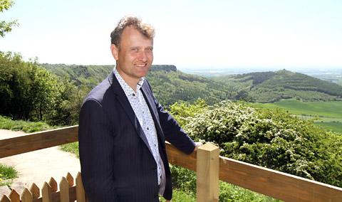
The idea is that if views could compete in the Olympics, views from the UK National Parks would be up there on the podium.

The competition will be judged by TV adventurer Ben Fogle President of the Campaign for National Parks (CNP), Kathryn Cook from the UK Association of National Park Authorities (UK ANPA) and Emily Carr from its partner organisation, outdoor gear specialist Merrell.

Ben Fogle said:  "The UK's National Parks offer some truly gold medal-winning views, which is why I think the UK National Parks team's idea to seek out fans' best photos is a great idea. I look forward to seeing some stunning views and to judging the winning landscape in May."

The winning image will be picked from a shortlist of up to 10 photographs and the lucky winner will get to pick one pair of footwear from Merrell’s excellent spring/summer 2012 collection.

The competition has already started and closes at noon on May 10th.  To upload your image, visit the Competition page on the National Park’s website here

Our website has some handy hints and tips for taking better landscape photographs - visit our page here.

Our May podcast will feature professional photographer Dan Santillo's top tips to help you too!  You can subscribe to our podcast on iTunes here.

Saturday, 11 February 2012

Walna Scar is for walking, horses and bikes only - finally


After 3 decades of uncertainty and legal wrangling, Walna Scar, one of the Lake District’s most popular fell passes, will not be open to motorised vehicles.

If you're not familiar with it, Walna Scar is in the Lake District National Park lying in the Coniston Hills - and the pass shares its name with a popular hill-walking summit.


The modern day debate about whether motorised vehicles should be allowed to use Walna Scar dates back to May 2006, when the pass was closed to mechanically propelled vehicular traffic because of the Natural Environment and Rural Communities (NERC) Act 2006.

Users of motor vehicles, however, claimed Walna Scar to be a BOAT - a Byway Open to All Traffic - using the exemption clause contained in the NERC Act 2006.


The Lake District National Park Authority assessed the BOAT modification order application, and concluded that the route should be a restricted byway (for all traffic except motorised vehicles) and this was made an order in 2007.

After several objections were made to this - and further evidence received - an independent inspector was appointed by the Secretary of State.  This inspector decided the route was a Byway Open to All Traffic – including motor vehicles, and on 15 June 2010 the route again became available for all traffic.

Following an appeal to the High Court, that inspector’s decision was been quashed, and the whole process started again.

Today, we have finally got a decision.

Members of the Lake District National Park Authority's Rights of Way Committee discussed the historical evidence and the effect of modern day legislation, and agreed that the route was a restricted byway, which effectively means only walkers, horse riders, cyclists and pony and trap drivers will legally be able to use the route.

However, it isn't a closed and done deal, as the public will have between 10th February and 1st April 2012 to object, which would then result in the matter being referred to the independent planning inspectorate.

Meanwhile, it remains illegal to use the route with a motorbike or four wheel drive vehicle.