Showing posts with label Walking Books. Show all posts

Thursday, 10 March 2016

A walk on the wild side? The Pembrokeshire section of the Wales Coast Path

For 186 breathtakingly rugged miles, the Pembrokeshire section of the Wales Coast Path promises days full of seabirds, seals, puffins and even the occasional dolphin. Tony Bowerman says it’s unmissable.


Green Bridge

It’s official: Pembrokeshire offers world-class walking. Recently voted the “world’s second-best coastal destination” by National Geographic magazine and, in 2011, named the second in a list of the “world’s top ten long distance paths”, the Pembrokeshire coast path is definitely a dream destination for walkers.  The lovely Pembrokeshire section of the Wales Coast Path undulates along the top of rugged cliffs, in and out of secluded coves and tiny harbours, and along numerous sandy beaches.
Strumble Head

From the remotest reaches of the north coast near Strumble Head on day one to the popular beaches around Tenby on the final day, it provides a wonderfully varied experience. Whether you come for the scenery or the solitude, the wildlife, Welsh history, language and culture, or simply to immerse yourself in an exceptional corner of Britain, Pembrokeshire certainly won’t disappoint.


Pembrokeshire’s unique qualities were recognised as far back as 1952 when it became one of Britain’s first National Parks. The path traverses several National Nature Reserves, lots of Sites of Special Scientific Interest and one of the UK’s four Marine Nature Reserves, all helping protect the area’s geology, habitats and wildlife.  Along the way, you’ll encounter countless seabirds — including puffins, peregrines, choughs, gannets and fulmars.  You’re also likely to see plenty of inquisitive seals, and if you’re lucky, porpoises and dolphins.  But most memorable, perhaps, are the spectacular carpets of maritime wildflowers that colour the cliffs and offshore islands in spring and early summer.

Pembroke Castle
As well as ever-changing scenery, the coast path is a walk through history too.  Cover the whole route over fourteen or so days and you’ll discover prehistoric burial chambers near Fishguard, Aberdraw and Manorbier, standing stones and hillforts, dramatic medieval castles at Pembroke and Manorbier again, tiny Celtic chapels and atmospheric St David’s Cathedral.  Several sections of the coast are also managed and protected by the National Trust.


Wonderful walks 

For the first few days, the Pembrokeshire section of the Wales Coast Path runs along the rugged north coast with its high, often remote and windswept cliffs. Along the way, it drops in to Newport, Fishguard and the tiny cathedral city of St David’s.

Once round the St David’s peninsula, the path enters St Bride’s Bay, with its hidden coves and historic headlands. Beyond the Marloes peninsula and St Ann’s Head, the coast becomes more developed around the Milford Haven, before rounding the Angle peninsula, and passing through spectacular limestone and sandstone scenery on its way to lovely Tenby and its end at Amroth, on the Pembrokeshire/Carmarthenshire border.

Carreg Samson cromlech
Favourite day walks include the section between Stack Rocks and Bosherton Lily Ponds, passing the amazing sea arch at the ‘Green Bridge of Wales’ and tiny St Govan’s Chapel hidden in a cleft in the cliffs. For a longer, two day walk,  I recommend the stretch from Strumble Head to Whitesands Bay. It’s got some of the best dramatic scenery on the whole Pembrokeshire coast and a host of prehistoric remains including the fascinating Carreg Samson cromlech.


More information:


For a detailed guide to the 186-mile linear route, get hold of a copy of the Official Guide: Wales Coast Path: Pembrokeshire by Vivienne Crow.

(ISBN  978-1-908632-23-4 | £13.99).

For details, see: Official Guide: Wales Coast Path: Pembrokeshire


Or if you prefer short, circular walks along the coast, try the two attractive pocket-size ‘Top 10 Walks’ books for the Wales Coast Path: Pembrokeshire — North and South, both by Dennis Kelsall.

(ISBNs  978-1-908632-29-6 and 978-1-908632-30-2 | £5.99 each).

For details, see: Pocket-size ‘Top 10 Walks’: Pembrokeshire


Saturday, 23 November 2013

Book Review – Lakeland Fellranger : The Far Eastern Fells by Mark Richards


With the gorgeous Upper Kentmere Valley inviting you on the front cover, you know there’s something special about this book.  The 332 pages also tell you this isn't a book done by halves.  Then you spot who it is written by – and you know you’re in for a good read.  And I mean that from the point of view that Mark Richards' text has a poetic flow to it which almost demands to be given more time to.  Many walking guide books only really work when you are using them on the fell – this works as well when you’re sitting at home using it to plan your next journey.  And that’s rare.  To highlight this is the inclusion of a fabric page marker – you don’t get that in a standard walking guide book.  This is a book intended to be read.

This book is the combination of an odyssey which began in 1989 when Mark Richards was still living in his native Oxfordshire.  Inspired by the great Alfred Wainwright to jump into writing, Mark launched himself into being a full-time preparer of walking guides – at the age of 40.  Strange, as in 2014 I turn that age too…  Is there something about that age…?

Anyway, as I mentioned, this book is the last in a series of eight books dedicated to walking the fells of the Lake District – with each of the eight books focusing on a different area.  After 14 years, Mark has walked the 227 fells mentioned in those books many times in all weathers and seasons – the result is a most complete set of walking guides for the Lakeland area, if you are lucky enough to possess all eight.


Now here’s where I have to tackle the inevitable comparisons to Wainwright.  Firstly, is seems wrong to call Mark “Richards” in the same way as we all use “Wainwright” so I’ll use MR and AW.  Ok.  MR has eight books in his series, whereas AW had seven (MR includes the Mid-Western Fells in a separate volume).  AW’s list of fells total the famous number of 214, whereas MR’s total 227 as I’ve mentioned.  It took MR 14 years to complete the eight books and Wainwright took 14 years to write his seven.

There are similarities too.  Like AW, MR – oh that’s enough, Mark – is quite the master at pen and ink drawings, and the products of this talent are liberally used throughout the book – both as pictorial guides to the different routes up fells, and as piece of art in their own right.  In this age of iPads and digital imagery, it’s so pleasing to see good traditional ways of illustrating in a major guide book.

The photos are from the author too – and this gives you a greater sense of trust in the words.  Here, you know that Mark has actually done these walks he is suggesting – a fact you can’t really be sure of if the photos are credited to a stock photographic library.  The photos might not be the atmospheric “I've wild camped for 3 days on this spot to get this moody sunrise” types of shots, but I can tell you I’d be proud to call any of them my own.  Especially Castle Crag on page 142 – which actually does qualify as a moody Lake District shot…

Great attention has been place in the design too.  The aforementioned line drawings and photographs are well spaced out, and indeed there isn't a page which doesn't contain a photo, a line drawing or a map.  And of the maps, there are two notable points.  Firstly, they are the Harvey versions – which provide a welcome change of style to the omni-present Ordnance Survey ones.  Secondly, the maps aren't constrained within boxes here, they are allowed to flow out and live on the page.  So much so, the maps often take over a full page – and on my favourite pages (102-103), the map almost covers the whole double page spread.  (yes I have favourite pages…  The panoramas are also well-made and very useful – laying out on a double page spread what exactly you can see from the summit of each fell.


So onto the routes and the descriptions thereof.  Well, here is Mark’s triumph with this book.  The words really describe in great detail what, where, how you can achieve your goal for reaching the summit of the fells.  To prepare this review, I followed Mark’s descriptions to 3 different fells, and found the detail to be astonishing – with a clever balance between direction and information.  I would never advocate anyone to go out walking in the Lake District without a map – but if my map was taken away from me, I’d want this book instead.  And Mark describes alternative routes to each of the summits – where possible – giving you additional walks in the future by taking the many different variations.

This book completes the eight-volume series.  So, is it possible to suggest the unthinkable?  Could this body of work become the definitive Lake District multi-volume walking guide?  Can the student topple his mentor?  Well, certainly, if a series of this quality and standing had been written about the Peak District say, it would easily be classed as the walking guide for the Peak.  The problem in the Lakes is that AW has got there before anyone else – and that makes it so tricky for anyone else to make their mark (a pun worthy of MR himself there)…

But – and I’m possibly going to lose some friends here – I think Mark’s have the edge.  Sure I enjoy reading AW’s guides and I respect and revere his writing and description – but Mark has the benefit of being around now.  He has the benefit also of the sum total of all the knowledge assembled since AW’s time too.  His guides are easier-to-read but still have an immaculate turn of phrase – which are modern and current.  And phrases will stick in your memory – just like with AW’s books.  It all leads me to prefer Mark’s books to AW’s…

Whether people will be doing the “Richards”, I’m not sure.  Again, perhaps if the series had been about a different area – yes.  But the “Wainwrights” are such a part of British walking culture now, it’s difficult to see that ever changing.  What will change, though, is people will be quoting from Mark’s books in years to come as readily as they do now from AW’s…

You mark my words… (I did it again)


 Lakeland Fellranger : The Far Eastern Fells by Mark Richards
published by Cicerone, priced £14.99
Walks Around Britain rating 9/10

Order it now online from Amazon here 

Wednesday, 24 July 2013

Book Review - Cardigan Bay North: Circular walks along the Wales Coast Path

Having already dispelled my original pre-conceptions of reasonably-priced pocket walking books, the next in the Top 10 Walks series from Northern Eye Books is most welcome dropping on the doormat.


“If it ain't broke, don't fix it” is that well-worn adage, and it is certainly true with the format of this books.  Bright and colourful, with a good number of excellent photographs and a modern, airy feel to the design is what the Top 10 Walks series is all about.  Have a look at my review of Pub Walks: Walks to Cumbria's Best Pubs.

This book is part of a growing sub-series focused on circular walks along different parts of the Wales Coast Path.  The Path opened in May 2012 – here’s our podcast with a feature about the opening – and stretches 870 miles from the outskirts of Chester in the north to Chepstow in the south.  Great play was made in the path’s first year of Wales being “the only country in the world with a path around its entire coast” – and indeed this book mentions this too.  The PR guys at the time seemingly forgot about the Isle of Man having the Raad ny Foillan coast path since 1986…  I’ll forgive the book including this line, as it was generally used at the time, but it’s interesting to note the official PR line now is “the longest continuous coastal path around a country.” – which is perfectly true.

This particular book is focused on the north part of Cardigan Bay and feature 10 walks which include a section along the Wales Coast Path and then via off to take in a special place, and then return back to the start.  Who better to choose 10 top walks in the area than Sioned Bannister.  Sioned hails from these parts, and has picked a collection of varied and interesting walks from the coast path, from Porthmadog in the north of the area to Borth in the south.

All of the walks have a shout to be included in the book, but I have a couple of particular favourites.

First is the Porthmadog route to summit of the hill which dominates the port – Moel-y-Gest.  Porthmadog is very familiar to me as it was one of the places we used to visit on the annual family holiday to North Wales when I was a child.  It’s also a place to go now as a mid point of two spectacular narrow gauge steam railways – so there’s lots of reasons to visit.  From the summit, the walk offers a fantastic view of the port of Porthmadog – named after William Alexander Madocks and his attempt to command the route between the newly joined capital cities of London and Dublin in the early 1800s.


The second of my favourite walks in the book is actually from Porthmadog again… but this time to the Italianate village of Portmeirion, the brainchild of Welsh architect Clough Williams-Ellis.


Beautiful images are liberally sprinkled throughout the book.
My last favourite from the book is the walk from Borth and along the Cardigan Bay part of the coast path and back into farmland for a contrast.  This is particular of interest as at low tide the remains of an ancient submerged forest is revealed.  This is from the ancient kingdom known locally as Cantre’r Gwaelod – which some of your “Coast” fanatics will remember for the 4th programme of the very first series.

10 walks in a bright, colourful and detailed book – complete with proper OS mapping which means you don't really need a separate map – all for £4.99.  It’s a real bargain, and although you can buy apps for your smartphone for less, they don't really have the detailed route descriptions or the beautiful photography this book does.

If you're in the market for 10 short walks in the Cardigan Bay area, then this is the book for you.


Cardigan Bay North: Circular walks along the Wales Coast Path by Sioned Bannister
published by Northern Eye Books.
Walks Around Britain rating 9/10

Order it now online from Amazon here or from the Northern Eye website here.

Wednesday, 13 March 2013

Walking and Outdoors books on the Kindle


The times are a-changing and the rise of e-readers - and in particular the Amazon Kindle - has brought a new way of reading books.

In contrast to some other genres, the walking and outdoor publishing community has been a bit slow on taking up making books available on the Kindle - or across devices like the iPad and Android tablets - but that is changing, and I've got a few of the best ones I've found here on our blog.


An area of England with an amazing amount of walks - and sadly very much overlooked is Warwickshire & West Midlands - was is why Richard Sale's book 100 Walks in Warwickshire & West Midlands is included here.  The walking territory in these two central counties remains largely undiscovered, better known, as they are for their towns and cities such as Stratford and Leamington.  Those willing to find out, however, will discover some wonderful countryside, and some surprisingly varied routes.

It's quite an old book - originally printed in 1996 - but the walks contained within are among the best in the area.  The maps are line drawings, not OS ones - but they are very clear and easy to read, with plenty of places of interest noted on each walk.


As our good friend Tanya Oliver pointed out in the sixth edition of the Walks Around Britain podcast, Sussex is a great country to walk around - and Richard Williamson's book 52 Favourite West Sussex Walks has a great selection in it.  Richard Williamson’s weekly walking column has long been one of the most popular features in the Chichester Observer, Worthing Observer and West Sussex Gazette, and for the first time he has compiled his favourite walks – one for every week of the year – with hand-drawn route maps.

Many here to to tempt you out onto the unspoiled nature of the timeless South Downs landscape and its varied flora, fauna and stories – from bat-birds and the Devil’s Jumps to beloved pubs and famous poets – combine with practical notes on routes that can be covered easily in an afternoon.


Although it's not a walking route book, but Tristan Gooley's latest book The Natural Explorer: Understanding Your Landscape: In Search of the Extraordinary Journey is certainly worth a mention here.  You wont find a map in this book, but you will learn how to read, understand and connect with the landscape.  I've got a review on this book on this blog soon, so I'm not revealing too much here, but I can tell you it's a cracking read.  And the best bit is that the Kindle edition is onnly £4.99 - saving nearly a massive £6 of the hardback price!

Tristan was on the Walks Around Britain podcast in May - here's the podcast along with the Show Notes on this blog.


Tripping North of the Border to the fabulous Isle of Skye, and the famous outdoor author Terry Marsh has written possibly the definitive book on walking and hiking on the island - The Isle of Skye: A Walker's Guide.

Most people are drawn to the island for the Cuillin, but there is more to Skye - and this book has 87 walks and scrambles.  The Isle of Skye has some of the most awe-inspiring scenery of Scotland's many islands. The walks are widely varied, and provide something for all abilities to enjoy.

The guide is one of the famous Cicerone walking books, who are more than half way through converting their epic collection of titles to electronic formats - and this is an e-book which benefits from using a Kindle app on a smartphone or on a computer, as it is in full colour.


And lastly, this very blog is available on the Kindle as well on a monthly subscription.

Tuesday, 29 January 2013

Book Review - the Lakeland Pack 2 by walkingbooks.com

 The phrase “book review” is possibly a slight misnomer, as this isn’t really a book at all.  Perhaps “pack review” would be more relevant – as this is one of the range published by Walking-books.com.


So what is it?  Well, it is a box which opens up to show a map on the left side of the region covered – the Lake District in this case – and on the right is the collection of walks.  These are on loose cards which are laminated and contain all the info about the route on one side and the route shown on an Ordnance Survey map on the reverse.


Walkingbooks.com originated this style of publication, and, as with any major innovation, found it copied by several other larger publishers.  However, generally speaking, the rivals have re-used walks they already had published in other books, whereas Walkingbooks.com's versions have been written from scratch.  The other major difference are the size of the pack – Walkingbooks.com (herein WB!) originated the style using an A5 sized pack, and the rivals have generally used a smaller format.


This is the second series of the packs published by WB and they've had a complete make-over from the first outings – which date way back to 1999.  Times and designs have moved on a lot since then, and fortunately WB have taken the opportunity to radically bring the layout and style into the 21st Century.
Firstly, the main difference is in the style of the pack; the original series of WB packs were made from a fairly lightweight cardboard - which damaged easily – and had a difficult opening flap - as seen on the left. That’s gone now, in favour of the much more sturdy box which opens easily to the left – like a book.


But that’s not as much of a difference compared to the design of the cards themselves… they have had a complete make-over.  The originals were a mass of plain text on one side, and the OS map on the flip side.  As I’m mentioned, WB have kept this style for the new packs, but a designer has given the layout a fresh feel.

These new cards have an info bar to the left of the card and another at the top, which give similar details to the “Essential Info” box on our own Walks Around Britain website.  The walking route itself is split into 4 or 5 numbered stages, which are highlighted on the OS map on the reverse of the card.

These numbered stages have type in two colours, with the black text describing the route and the blue text providing interesting information – such as historical details, stories and such like.  This method works very well, the helps you distinguish between the route and the additional details.
Another handy feature is the correct Ordnance Survey map number is shown at the bottom left hand corner for each card – along with contact details for the relevant Tourist Information Centre for that walk.

OS Maps on The Lakeland Pack 2
Turning the card over shows the Ordnance Survey map for the walk – and this is really WB’s major selling point, as almost all the competitor packs of a similar style don’t have full-blown 1:25,000 Explorer mapping on their cards.  But here is my first, and really only, note of disappointment.
OS Maps on the older packs

The quality of the maps are a bit of a let-down; they tend to be a fuzzy and not very sharp.  Some are better than others, but I do feel perhaps the OS hadn’t supplied high enough quality mapping to WB for the printing process.  Ironically, this is the only point in which the original series of packs are better – as the quality of the OS maps in those are excellent and pin sharp.


Accompanying the pack is a booklet which at first glance only details how to use the walking cards.  But the booklet actually is a tiny treasure, with information about walking safety, suitable clothing & equipment and much more.  And finally, hiding underneath all the walking sheets is a clear plastic wallet which you can pop a card into, keeping it safe and dry from the Lake District weather.


What are the walking routes?  Well, in this pack there is a great mix of easy, moderate, difficult and strenuous, and there’s also a nice spread across the whole of the Lakeland area – not just sticking to the honey pot of the Central Lakes.  Heck, there’s even a walk in Barrow-in-Furness – part of the area not often covered by walking books.


My favourite is perhaps number 12 – a 4 ½ mile wander from Waterhead through Troutbeck to the Lake District Visitors Centre at Brokehole – a lovely walk.  But then, so are the other 24.  Jim Rubery and Michael Law have selected some crackers, and you won’t be disappointed with any of them.

So, is this new series of walking packs from WB an improvement on the originals?  Definitely.  The box is stronger and won’t get squashed in your backpack; the cards are laminated and won’t get damaged on route; they have a fresh, clean design which is easy to follow and get the info you need – and the 25 walks offered are top routes too.  It’s just a shame about the fuzziness of the OS maps…


What’s good
The 25 walks are stunning and well worth trekking out on
Walking cards are laminated and should be safe to use in most weather
Clean, fresh inviting design of the walking cards
Sturdy box which won’t get squashed easily
Extremely helpfully booklet

What’s bad
Quality of the OS maps – a few are fuzzy and not too sharp.
Perhaps slightly expensive for fair weather walkers


 The Lakeland Pack 2 by walkingbooks.com - Rough Price - £14.99

Walks Around Britain rating  8/10

Order it online from Amazon here.

Friday, 14 December 2012

Podcast Edition 012 - Show Notes


Edition 12 of the Walks Around Britain podcast is a special dedicated to helping you with Christmas with some top gifts ideas for walking and outdoor people.  If you're still searching for Christmas gift inspiration, then perhaps you'll find some here...


Mountain House navigation courses

These make a great gift for any outdoor person.  Join their popular Hill and Moorland Navigation courses based in the Derbyshire Peak District.  They offer a range of 1 day courses, with a flexible and individual approach designed for both novice and more experienced walkers.  For more info, visit their website


Outwell

Quality camping people Outwell have some fantastic gifts suitable for Christmas presents - despite Andrew's initial hesitancy...  How about the On Air Digital Radio for instance?  Find out all about the products Clive talked about by visiting their website.


Mendip Hills AONB "8 Wild Walks"

The walks, devised by local landscape ecologist Adrian Boots, range from just over 2 miles (4km) to just over 7 miles (12km) take you through a wide variety of landscape types in the Mendip Hills AONB including steep scarp slopes with impressive views across the Levels, windswept plateau criss-crossed with dry stone walls, valley village to lakeside and all with the opportunity to see a variety of wildlife that will change according to the seasons. The guide also includes fascinating facts on plants and wildlife and where to look out for them.

For details of all the stockists and for how to order by mail, visit http://www.mendiphillsaonb.org.uk/publications/


Treasure Trails

Treasure Trails create fun and unique ways to get outside and explore.  They currently have over 1,000 Treasure Trails throughout the UK and are writing more every day.

For more information about the trails on offer, visit their website http://www.treasuretrails.co.uk


Chocolate Fish Merino

For all things Merino, click on the Chocolate Fish Merino website here.

And for a good read, check out their blog - http://chocolatefishmerino.blogspot.co.uk/


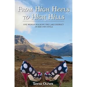
From High Heels to High Hills

From the pen of one of the familiar voices from the Walks Around Britain podcast, Tanya Oliver's first book tells the story of her passion for the mountains of the Lake District and how she’s conquered them - in her own style.

Well worth a read :)

To order from Amazon click here, and to find Tanya's blog, visit here.


Scotland End to End

Documenting the recently opened Scottish National Trail, Cameron McNeish's new book is a great read - and a fantastic guide to the 470 mile route between Kirk Yetholm and Cape Wrath.

As one of the driving forces behind the trail, Cameron is perhaps the most suited to write this book.

For more information, visit the Mountain Media website or to order from Amazon, click here.


Well, that's it - hope you all have a great Christmas and we'll see you for another podcast on the 1st January!

Thursday, 11 October 2012

Derbyshire and The Peak District: A dog walker's guide


When you've got dogs, it is sometimes hard to find walking routes suitable for them.  Treks you think look great on the OS map can often be obstructed by stiles and other hazards.

That was the reasoning behind Peter Naldrett's latest book Derbyshire & The Peak District: A Dog Walker's Guide - published by Countryside Books.

Talking about the book, Peter said "I know from my own experience that it is hard to be sure, once you are off your home patch, where you can walk safely with your dog without the frustration of getting lost, finding your route blocked with impassable stiles or encountering busy roads.  I have put together this collection of dog-friendly walks so that others can discover Derbyshire and The Peak District’s glorious countryside without these frustrations'.

The 20 circular routes have been designed with maximum off-lead time and minimum exposure to roads, and vary in length from 2 to 5¾ miles.  Each walk has information on the distance and terrain, livestock likely to be encountered, number and type of stiles en route and, in an emergency, the nearest veterinary surgery.  In addition to the clear, numbered route instructions, each section also includes a matching numbered map, information on how to get to the start, places of interest along the way, and local pubs and cafes which welcome dogs.


The routes give dogs and their owners the chance to explore the glorious countryside of Derbyshire and the Peak District, with walks beside the river Dove in beautiful Dovedale; over Monsal Head with its breath-taking views; around Torside Reservoir and Ladybower Reservoir, surrounded by lush meadows and woodland; through Poolsbrook Country Park, a glorious example of regenerated land; and along the river of Lathkill Dale with its tumbling weirs and lovely views.

There is also the chance to see the historic ‘plague village’ of Eyam; the ancient packhorse trail on Stanage Edge; impressive Chatsworth House; and many charming and picturesque villages such as Tissington, Osmaston and Milton.


‘I hope my book will provide readers and their dogs with many happy hours of inspiring and enjoyable walks together’ says Peter Naldrett.  ‘Happy walking!’


DERBYSHIRE & THE PEAK DISTRICT: A DOG WALKER’S GUIDE by PETER NALDRETT is published by Countryside Books and is available from all good booksellers, some local garden centres and attractions and direct from the publishers at www.countrysidebooks.co.uk.


And don't forget we put information about the dog-friendliness of each walk on our website, and we've made some specific dog-friendly walking videos in association with Bob Martin.  Here's our walk along Ladybower Reservoir in the Peak District...


Wednesday, 4 July 2012

10 Ways To Walk More

We all know that walking isn't just great at the weekend through the Lake District but also something we should be doing more of all the time - it keeps us healthy in body, mind and soul.


So here's a few ways the team here at Walks Around Britain have introduced more walking into our week...


1. Take Your Lunch

Photo - MyUrbanLife
On average, us Brits only take 22 minutes a day of our lunch hour we're entitled to.

Strike a blow for the workers - take the whole one hour and find a place to eat that's a 30 minute round trip walking from your office - 30 minutes eating and 30 minutes walking - excellent.


2.  Listen to your Reading

If you're a bit of a bookworm, why not combine your love of books with your walking?  Lots of books are now released as audio books too - which you could loan from the library or from websites like Audible - which you can listen to on your walks.  If you're happy about to listening to a computer-style voice, certain versions of the Kindle e-book reader from Amazon - like the Kindle Touch - will read aloud most e-books, albeit sometimes with some distinctly odd pronouncation in some instances.

You can always listen to our monthly walking and outdoor podcast whilst out walking - download them from iTunes here. :)


3. Raise some money

For a more long term goal, there are plenty of sponsored walks you can sign up to which raise money for some great good causes.  Two very interesting ones are the Shine walks - which are night time walking marathons taking place in London (September 29th) and Manchester (September 8th) at night, passing well known landmarks along the route.  The organisers are expecting to have 15,000 participants this year and hope to raise £3.5m for Cancer Research UK.  To find out more info, visit the Shine website.


4. Walk to Work - at least once a week

Photo - Living Streets
If you're within walking distance from your work, how about doing just that - at least once a week.

You'll soon see the benefit to your health.

To find out more about walking to work, visit the Living Streets website.


5. Park a Little Bit Away

If you need to drive to work, how about parking 10 minutes away from your office - that way you've got another 20 minutes of walking exercise every day.  And if you pay for your parking, the chances are car parking further away from your office might well be cheaper than where you are parking now.


6. Use the Stairs

Seems an easy suggestion, but if you avoid the lift and use the stairs for a long period, you can greatly increase your lung capacity, blood pressure and cholesterol measurements.


7. Pack up your baby


If you're a new parent, leave the buggy or push-chair behind and take your little one out in a baby carrier harness.  This gives you both unbelievable closeness to your child as well as the ability to go for walks which aren't accessible to buggies.

It's a great way to get your child feeling the wonder of the fresh air whilst at the same time.


8. Get a Dog

According to a Canadian study, urban dog owners are more likely to walk on average almost double the amount non-dog owners did.  There's also many other health benefits now recognised in dog ownership, including the lowering of blood pressure, an increase in mood and others.

But obviously, a dog is for life and should be well considered before taking a puppy on.


9. Take a walking City Break

A long weekend in often takes the form of a trip to the countryside or the coast, but how about an urban minibreak?  There are some great towns and cities across Britain which have great history and stories to tell if you just do a little research.  Link together a couple days of urban walking with a trip to the theatre, great restaurants and museums, and you've got a great break away.

Take a look at our walk around Newcastle-Upon-Tyne's city centre for some inspiration.


10. Use technology to get out walking more

With modern technology as it is now, you often don't have to be in the office to do work, or communicate with people.  Use technology such as smartphones with Twitter and Skype to keep in touch whilst walking and try to schedule television programmes on personal video recorders, such as Sky + or Freeview +.  And don't forget, there's always the BBC's iPlayer and the commercial equiviants to catch up with tv you've missed whilst out walking.